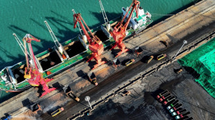
Less mapped than the Moon: quest to reveal the seabed / Photo: © AFP/File
 Iranian climber who competed without hijab leaves country: family

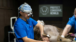 First brown bear to have brain surgery emerges from hibernation

 Fears grow of renewed conflict in Ethiopia's Tigray

 Belgium carries out raids in EU parliament corruption probe


 'Impossible' to drop Dupont stand-in Lucu for France Six Nations title decider

 Lucu replaces Dupont for France Six Nations title decider

 Food app Deliveroo delivers first annual profit

 Less mapped than the Moon: quest to reveal the seabed

 Hundreds of fans vie for glimpse of homecoming MLB hero Ohtani

 Taiwan plans to reinstate military judges for China spy cases

 Asian stocks hit as trade worries overshadow upbeat US inflation

 Couche-Tard bosses make case in Tokyo for 7-Eleven buyout

 All-women marching band livens up Taiwanese funerals

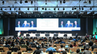
 Ukraine ceasefire bid, trade war to dominate as G7 diplomats meet

 Drivers welcome Domenicali continuing as F1 chief until 2029

 Shai scores 34 as Thunder down Celtics, seal playoff berth
 Australia tells US influencer: 'leave baby wombat alone'

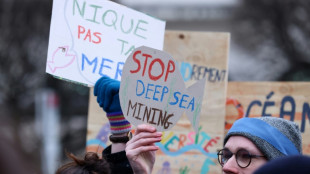 'Sound science' must guide deep-sea mining: top official

 Trump optimistic about potential Ukraine ceasefire

 Asian stocks wobble as US inflation fails to ease trade worries
 Mullins's Galopin des Champs bids to join Gold Cup legends

 France hot favourites to win three-way battle for Six Nations crown

 Penalty controversy as Real reach Champions League quarters, English duo advance

 Trump's Canada fixation: an expansionist dream

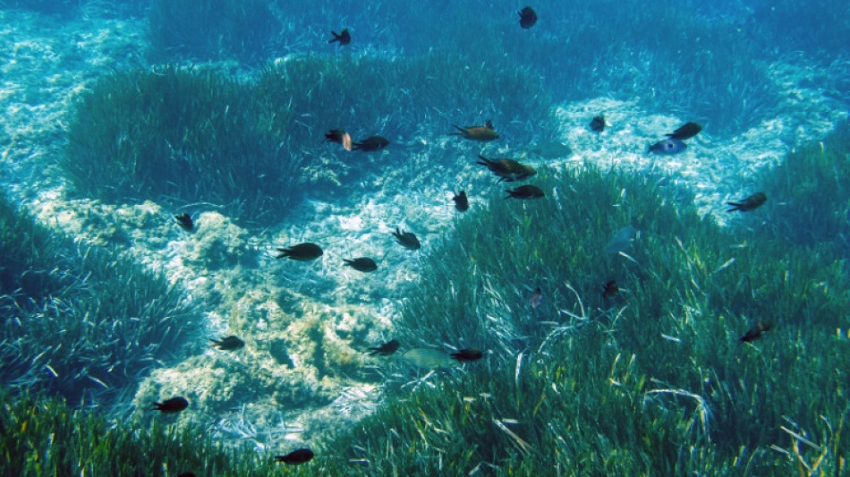
It covers nearly three-quarters of our planet but the ocean floor is less mapped than the Moon, an astonishing fact driving a global push to build the clearest-ever picture of the seabed.
Understanding the ocean depths is crucial for everything from laying undersea cables and calculating tsunami paths, to projecting how seas will rise as the climate warms.
When Seabed 2030 launched in 2017, just six percent of the ocean floor was properly mapped.
The project has since boosted that figure to over 25 percent, harnessing historic data, sonar from research and industry vessels, and growing computing power.
"As we put more data together, we get this beautiful picture of the seafloor, it's really like bringing it into focus," said Vicki Ferrini, head of the project's Atlantic and Indian Ocean Centre.
"You start to see the details and the patterns, you start to understand the (ocean) processes in a different way," added Ferrini, a senior research scientist at Columbia University's Lamont-Doherty Earth Observatory.
Satellite technology means we can now zoom in on the surface of the Moon, or a neighbourhood half-way around the world, but when it comes to the ocean floor, there's a basic problem.
"It's physics," said Ferrini. "The water is in the way."
While instruments can peer through relatively shallow depths to the sea floor, for most of the ocean only acoustic methods are viable -- sonar that pings the seabed and returns data on depths.
In the past, most ships used single beam sonar, sending down a single echo and offering one data point at a time.
Nowadays, multibeam sonar is common, explained Martin Jakobsson, dean of earth and environmental science at Stockholm University and co-head of Seabed 2030's Arctic and North Pacific centre.
"You get a swathe, almost like a 3D view directly, and that's really what we want to map the ocean with."
- 'More geopolitical than ever' -
But the availability of multibeam sonar did not translate into a central clearing house for data, and not all data collection is equal.
Different vessels collect at different resolutions, and data capture can be affected by the turbidity of the ocean and even the tides.
Collating, correcting and integrating that data is where Seabed 2030 has come in.
"We have this real patchwork," said Ferrini. "We do our best to weave it all together... making sure that we are normalising and justifying all of these measurements."
The project has set relatively coarse resolution targets for mapping -- grid cell sizes of 400 metres squared (4,300 square feet) for most of the ocean floor -- but even achieving that is a complicated process.
"It's a cost issue, it's also a 'people don't know why it's needed' issue," Jakobsson said.
"And right now it's more geopolitical than ever before," he added, particularly in the heavily contested Arctic.
- 'Just beautiful' -
The project has benefitted from some technological advances, including the spread of multibeam sonar and growing computing power.
Machine learning helps with data processing and pattern recognition, and can even enhance imagery and try to fill in some gaps.
"As we start to bring together each trackline and paint the picture more completely... we start to see these incredible meandering channels on the seafloor that look just like what we see on land," said Ferrini.
It is "just beautiful," she added.
Part of the project, which is funded by the Japanese non-profit Nippon Foundation, has been finding the biggest gaps in seafloor knowledge, most often in the open sea and areas outside common shipping routes.
Autonomous platforms equipped with sonar that can float at sea could speed up data collection, although for now uncovering "hidden" data that is sitting unshared is helping fill many gaps.
The work comes as countries debate whether to open stretches of the seabed to the mining of minerals used in the energy transition.
It is a divisive question, and like many scientists Ferrini warns against proceeding without more research.
"We need to have the data so we can make data-informed decisions, and we don't yet."
A.Gasser--BTB