-
 Left-wing candidate Orsi projected to win Uruguay election
-
UAE arrests three after Israeli rabbi killed

-
 Five days after Bruins firing, Montgomery named NHL Blues coach
-
Orlando beat Atlanta in MLS playoffs to set up Red Bulls clash

-
 American McNealy takes first PGA title with closing birdie
-
Sampaoli beaten on Rennes debut as angry fans disrupt Nantes loss

-
 Chiefs edge Panthers, Lions rip Colts as Dallas stuns Washington
-
Uruguayans vote in tight race for president

-
 Thailand's Jeeno wins LPGA Tour Championship
-
'Crucial week': make-or-break plastic pollution treaty talks begin

-
 Israel, Hezbollah in heavy exchanges of fire despite EU ceasefire call
-
Amorim predicts Man Utd pain as he faces up to huge task

-
 Basel backs splashing the cash to host Eurovision
-
Petrol industry embraces plastics while navigating energy shift
-
 Italy Davis Cup winner Sinner 'heartbroken' over doping accusations
-
Romania PM fends off far-right challenge in presidential first round

-
 Japan coach Jones abused by 'some clown' on Twickenham return
-
Springbok Du Toit named World Player of the Year for second time

-
 Iran says will hold nuclear talks with France, Germany, UK on Friday
-
Mbappe on target as Real Madrid cruise to Leganes win

-
 Sampaoli beaten on Rennes debut as fans disrupt Nantes loss
-
Israel records 250 launches from Lebanon as Hezbollah targets Tel Aviv, south

-
 Australia coach Schmidt still positive about Lions after Scotland loss
-
Man Utd 'confused' and 'afraid' as Ipswich hold Amorim to debut draw

-
 Sinner completes year to remember as Italy retain Davis Cup
-
Climate finance's 'new era' shows new political realities
-
 Lukaku keeps Napoli top of Serie A with Roma winner
-
Man Utd held by Ipswich in Amorim's first match in charge

-
 'Gladiator II', 'Wicked' battle for N. American box office honors
-
England thrash Japan 59-14 to snap five-match losing streak

-
 S.Africa's Breyten Breytenbach, writer and anti-apartheid activist
-
Concern as climate talks stalls on fossil fuels pledge
-
 Breyten Breytenbach, writer who challenged apartheid, dies at 85
-
Tuipulotu try helps Scotland end Australia's bid for Grand Slam

-
 Truce called after 82 killed in Pakistan sectarian clashes
-
Salah wants Liverpool to pile on misery for Man City after sinking Saints

-
 Berrettini takes Italy to brink of Davis Cup defence
-
Lille condemn Sampaoli to defeat on Rennes debut

-
 Basel backs splashing the bucks to host Eurovision
-
Leicester sack manager Steve Cooper

-
 IPL auction records tumble as Pant, Iyer break $3 mn mark
-
Salah sends Liverpool eight points clear after Southampton scare

-
 Key Trump pick calls for end to escalation in Ukraine
-
Tuipulotu try helps Scotland end Australia's bid for a Grand Slam

-
 Davis Cup organisers hit back at critics of Nadal retirement ceremony
-
Noel in a 'league of his own' as he wins Gurgl slalom

-
 A dip or deeper decline? Guardiola seeks response to Man City slump
-
Germany goes nuts for viral pistachio chocolate

-
 EU urges immediate halt to Israel-Hezbollah war
-
Far right targets breakthrough in Romania presidential vote


Satellites link rain, drought intensity to global warming
The intensity of extreme water cycle events -- especially drought and precipitation or flooding -- correlates strongly with a continuing rise in global temperatures, according to a study published Monday.
Applying a novel method, researchers used satellite observations to quantify and rank more than a thousand extreme weather events over the last 20 years that have up to now defied easy measurement.
Rainfall and soil moisture -- or the lack of it -- have previously been the main yardstick for assessing intensity.
"Warm air increases evaporation so that more water is lost during droughts, and warm air also holds and transports more moisture, increasing precipitation during wet events," co-author Matthew Rodell of NASA told AFP.
"So what we are seeing –- greater intensity of extreme wet and dry events as the world warms -– makes sense."
Since 2015, the frequency of the highest category extreme events has increased to four per year, compared to three per year over the previous 13 years, the study reported.
The scientists were nonetheless surprised at how closely the pace of global warming tracked with the intensity of disruptions in the water cycle.
The impact was even stronger than naturally occurring El Nino and La Nina weather phenomena, they reported in the journal Nature Water.
The findings leave little doubt that increasing temperatures will cause more frequent, widespread and severe droughts and precipitation events in the future.
Earth's surface has warmed, on average, 1.2 degrees Celsius since the late 19th century, and -- on current policies -- is on track to heat up 2.8C above that benchmark by 2100.
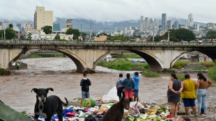
By far the largest extreme event of the past 20 years was a sustained deluge over central Africa that "dwarfed" all the others measured.
- Bracing for worse -
It caused Lake Victoria to rise by over a metre (3.3 feet) and was still ongoing in 2021 when the study concluded.
"It's probable that the string of top-ten warmest years (2015-2023) is helping to sustain these ongoing events longer than they would have under more normal global temperature conditions," said Rodell.
About 70 percent of the events measured lasted six months or less, with an average duration of five to six months.
Roughly a third of the top 30 wet and dry events globally occurred in South America. More broadly, the correlations were particularly strong in tropical climates.
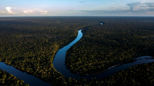
The most intense dry event registered happened in the Amazon during the hottest year on record.
The research offers concrete support for the IPCC's most recent assessment report, which found that the severity of extreme water cycle events is increasing.
Extreme droughts and floods are ranked as some of the world's worst disasters with huge impacts for the economy, agriculture and society.
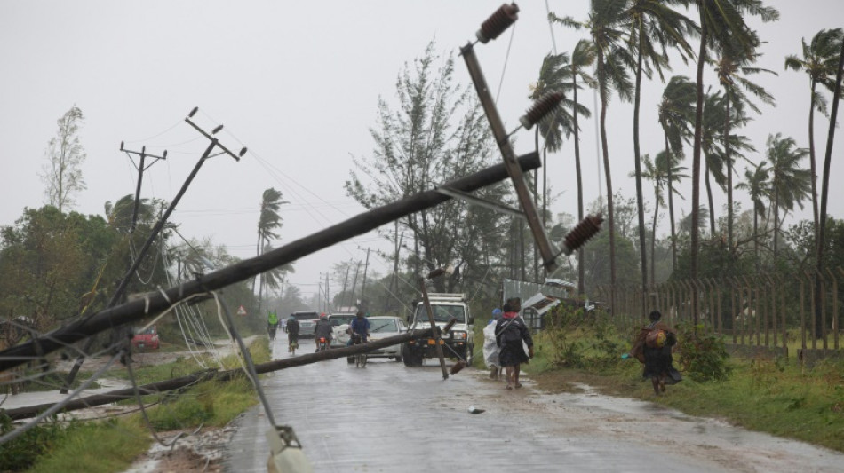
Tropical cyclone Freddy made a loop rarely seen by meteorologists when it returned to hit Mozambique for a second time on Monday, killing at least 70 people in Malawi and Mozambique and displacing thousands.
It is on track to be named the longest cyclone on record after its initial landfall in late February.
"The conclusion of this study suggests that preparation and adaptation will be that much more important in the future," said Rodell.
R.Adler--BTB

