-
 Noel in a 'league of his own' as he wins Gurgl slalom
-
A dip or deeper decline? Guardiola seeks response to Man City slump

-
 Germany goes nuts for viral pistachio chocolate
-
EU urges immediate halt to Israel-Hezbollah war

-
 Far right targets breakthrough in Romania presidential vote
-
Basel votes to stump up bucks to host Eurovision

-
 Ukraine shows fragments of new Russian missile after 'Oreshnik' strike
-
IPL auction records tumble as Pant and Iyer snapped up

-
 Six face trial in Paris for blackmailing Paul Pogba
-
Olympic champion An wins China crown in style

-
 It's party time for Las Vegas victor Russell on 'dream weekend'
-
Former Masters champion Reed seals dominant Hong Kong Open win

-
 Norris applauds 'deserved' champion Verstappen
-
Jaiswal and Kohli slam centuries as Australia stare at defeat

-
 Kohli blasts century as India declare against Australia
-
Verstappen 'never thought' he'd win four world titles

-
 Former Masters champion Reed wins Hong Kong Open
-
Awesome foursomes: Formula One's exclusive club of four-time world champions

-
 Smylie beats 'idol' Cameron Smith to win Australian PGA Championship
-
Five key races in Max Verstappen's 2024 title season

-
 Max Verstappen: Young, gifted and single-minded four-time F1 champion
-
'Star is born': From homeless to Test hero for India's Jaiswal

-
 Verstappen wins fourth consecutive Formula One world title
-
Survivors, sniffing dogs join anti-mine march at Cambodia's Angkor Wat

-
 Far right eye breakthrough in Romania presidential vote
-
Jaiswal slams majestic 161 but Australia fight back in Perth

-
 Edinburgh's alternative tour guides show 'more real' side of city
-
IPL teams set to splash the cash at 'mega-auction' in Saudi Arabia

-
 Olympics in India a 'dream' facing many hurdles
-
Wounded Bangladesh protesters receive robotic helping hand

-
 Majestic Jaiswal 141 not out as India pile pain on Australia
-
Giannis, Lillard lead Bucks over Hornets as Spurs beat Warriors

-
 Juan Mata agent slammed as 'cowardly' by angry A-League coach
-
Marta inspires Orlando Pride to NWSL title

-
 Palestinian pottery sees revival in war-ravaged Gaza
-
Main points of the $300 billion climate deal

-
 Robertson wants policy change for overseas-based All Blacks
-
Israel retreat helps rescuers heal from October 7 attack

-
 Afghan women turn to entrepreneurship under Taliban
-
Mounting economic costs of India's killer smog

-
 At climate talks, painstaking diplomacy and then anger
-
Uruguayans head to polls with left hoping for comeback

-
 Trump's mass deportation plan could end up hurting economic growth
-
Iran director in exile says 'bittersweet' to rep Germany at Oscars

-
 US consumers to bargain hunt in annual 'Black Friday' spree
-
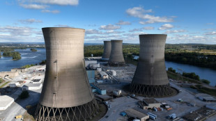
Cheers, angst as US nuclear plant Three Mile Island to reopen
-
 Scientists seek miracle pill to stop methane cow burps
-
Australia ditches plans to fine tech giants for misinformation

-
 Developing nations slam 'paltry' $300 bn climate deal
-
Red Bulls win 'Hudson River derby' to reach conference final


Monster Hurricane Ian hammers Florida
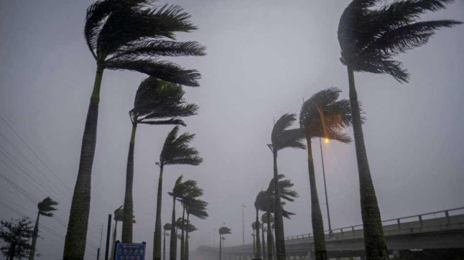
Heavy winds and rain pummelled Florida on Wednesday as Hurricane Ian intensified to just shy of the strongest Category 5 level, threatening to wreak "catastrophic" destruction on the southern US state.
Forecasters warned of a looming once-in-a-generation calamity, with life-threatening storm surges, extensive flooding and devastating winds promising what Florida Governor Ron DeSantis called a "nasty" natural disaster.
The National Hurricane Center (NHC) said in its latest advisory that the "extremely dangerous eyewall of Ian (was) moving onshore" and bringing sustained winds of 155 miles (250 kilometers) per hour, just two mph shy of Category 5 intensity -- the strongest category on the Saffir-Simpson scale.
Some 2.5 million people were under mandatory evacuation orders in a dozen coastal Florida counties, with voluntary evacuation recommended in several others.
With the golden hour to flee having past -- and hurricane force winds nearly touching southwestern Florida -- authorities were advising residents to hunker down and stay indoors.
"Ian has strengthened into an extremely dangerous Category 4 hurricane," the NHC said, warning of "catastrophic storm surge, winds, and flooding."
Airports in Tampa and Orlando stopped all commercial flights, and some 337,000 households were already without power.
"This is going to be a nasty, nasty day, two days," DeSantis said.
"It could make landfall as a Category 5, but clearly this is a very powerful major hurricane that's going to have major impacts."
With conditions rapidly deteriorating, some thrill-seekers were seen walking in the mud flats of Tampa Bay and in Charlotte Harbor, further south, ahead of Ian's arrival.
The storm was expected to roar ashore in the coming hours near Fort Myers and Port Charlotte, along the state's west coast, before moving across central Florida and emerging in the Atlantic Ocean by late Thursday.
With up to two feet (61 centimeters) of rain expected to fall on parts of the so-called Sunshine State, and a storm surge that could reach devastating levels of 12 to 18 feet (3.6 to 5.5 meters) above ground, authorities were warning of dire emergency conditions.
"This is a life-threatening situation," the NHC warned.
- Widespread blackout -
Ian a day earlier had plunged all of Cuba into darkness after battering the country's west as a Category 3 for more than five hours before moving back out over the Gulf of Mexico.
The storm damaged Cuba's power network and left the island "without electrical service," state electricity company Union Electrica said.
Only the few people with gasoline-powered generators had electricity on the island of more than 11 million people.
Others had to make do with flashlights or candles at home, and lit their way with cell phones as they walked the streets.
"Desolation and destruction. These are terrifying hours. Nothing is left here," a 70-year-old resident of the western city of Pinar del Rio was quoted as saying in a social media post by his journalist son, Lazaro Manuel Alonso.
At least two people died in Pinar del Rio province, Cuban state media reported.
- 'Historic event' -
In the United States, the Pentagon said 3,200 national guardsmen had been called up in Florida, with another 1,800 on the way.
FEMA (Federal Emergency Management Agency) administrator Deanne Criswell warned that Ian's "painful impacts" were being felt even before the hurricane's landfall.
National Weather Service director Ken Graham echoed concerns about what lies ahead, expressing certainty Ian will leave a trail of destruction.
"This is going to be a storm we talk about for many years to come," he said. "It's a historic event."
As climate change warms the ocean's surface, the number of powerful tropical storms, or cyclones, with stronger winds and more precipitation is likely to increase.
The total number of cyclones, however, may not.
According to Gary Lackmann, a professor of atmospheric science at North Carolina State University, studies have also detected a "potential link" between climate change and what is known as rapid intensification -- when a relatively weak tropical storm surges to a Category 3 hurricane or higher in a 24-hour period, as happened with Ian.
"There remains a consensus that there will be fewer storms, but that the strongest will get stronger," Lackmann told AFP.
E.Schubert--BTB

